
UPDATE – VERSION 4: THE SRTM DATA NOW AVAILABLE FROM THIS SITE HAS BEEN UPGRADED TO VERSION 4. THIS LATEST VERSION REPRESENTS A SIGNIFICANT IMPROVEMENT FROM PREVIOUS VERSIONS, USING NEW INTERPOLATION ALGORITHMS AND BETTER AUXILIARY DEMs. WE ARE CONFIDENT THIS IS NOW THE HIGHEST QUALITY SRTM DATASET AVAILABLE
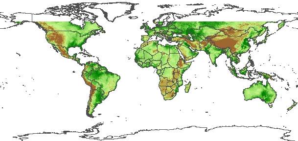
The CGIAR-CSI GeoPortal is able to provide SRTM 90m Digital Elevation Data for the entire world. The SRTM digital elevation data, produced by NASA originally, is a major breakthrough in digital mapping of the world, and provides a major advance in the accessibility of high quality elevation data for large portions of the tropics and other areas of the developing world. The SRTM digital elevation data provided on this site has been processed to fill data voids, and to facilitate it’s ease of use by a wide group of potential users. This data is provided in an effort to promote the use of geospatial science and applications for sustainable development and resource conservation in the developing world. Digital elevation models (DEM) for the entire globe, covering all of the countries of the world, are available for download on this site. The SRTM 90m DEM’s have a resolution of 90m at the equator, and are provided in mosaiced 5 deg x 5 deg tiles for easy download and use. All are produced from a seamless dataset to allow easy mosaicing. These are available in both ArcInfo ASCII and GeoTiff format to facilitate their ease of use in a variety of image processing and GIS applications. Data can be downloaded using a browser or accessed directly from the ftp site. If you find this digital elevation data useful, please let us know at csi@cgiar.org
The NASA Shuttle Radar Topographic Mission (SRTM) has provided digital elevation data (DEMs) for over 80% of the globe. This data is currently distributed free of charge by USGS and is available for download from the National Map Seamless Data Distribution System, or the USGS ftp site. The SRTM data is available as 3 arc second (approx. 90m resolution) DEMs. A 1 arc second data product was also produced, but is not available for all countries. The vertical error of the DEM’s is reported to be less than 16m. The data currently being distributed by NASA/USGS (finished product) contains “no-data” holes where water or heavy shadow prevented the quantification of elevation. These are generally small holes, which nevertheless render the data less useful, especially in fields of hydrological modeling.
Dr. Andy Jarvis and Edward Guevara of the CIAT Agroecosystems Resilience project, Dr. Hannes Isaak Reuter (JRC-IES-LMNH) and Dr. Andy Nelson (JRC-IES-GEM) have further processed the original DEMs to fill in these no-data voids. This involved the production of vector contours and points, and the re-interpolation of these derived contours back into a raster DEM. These interpolated DEM values are then used to fill in the original no-data holes within the SRTM data. These processes were implemented using Arc/Info and an AML script. The DEM files have been mosaiced into a seamless near-global coverage (up to 60 degrees north and south), and are available for download as 5 degree x 5 degree tiles, in geographic coordinate system – WGS84 datum. These files are available for download in both Arc-Info ASCII format, and as GeoTiff, for easy use in most GIS and Remote Sensing software appications. In addition, a binary Data Mask file is available for download, allowing users to identify the areas within each DEM which has been interpolated.
MIRROR DOWNLOAD SITE: Dr. Mark Mulligan (King’s College London) mirrors the data, and has created a Google Earth Interface for browsing and downloading SRTM tiles. it also provides smaller (1 by 1 degree) tiles for users who have difficulty with the 5×5 degree tiles as well as 2D and 3D visualisation of the data.
Google Link: http://www.ambiotek.com/topoview
Download SRTM KML file click here
Download Google-Earth click here
The CGIAR-CSI has produced this website under the guidance of Dr. Robert Zomer, and the support of the International Water Management Institute (IWMI). Database search, data display, and download programming was implemented by GENESIIS Software. Many thanks to CGNET for hosting the database and tech support.
Funding for this project has been provided by the CGIAR ICT-KM Program: ICT for Tomorrow’s Science Initiative.
Last Update: November of 2018